Register now
Send your details through the Google Form and our admins will contact you.
 Dragonfly aerospace
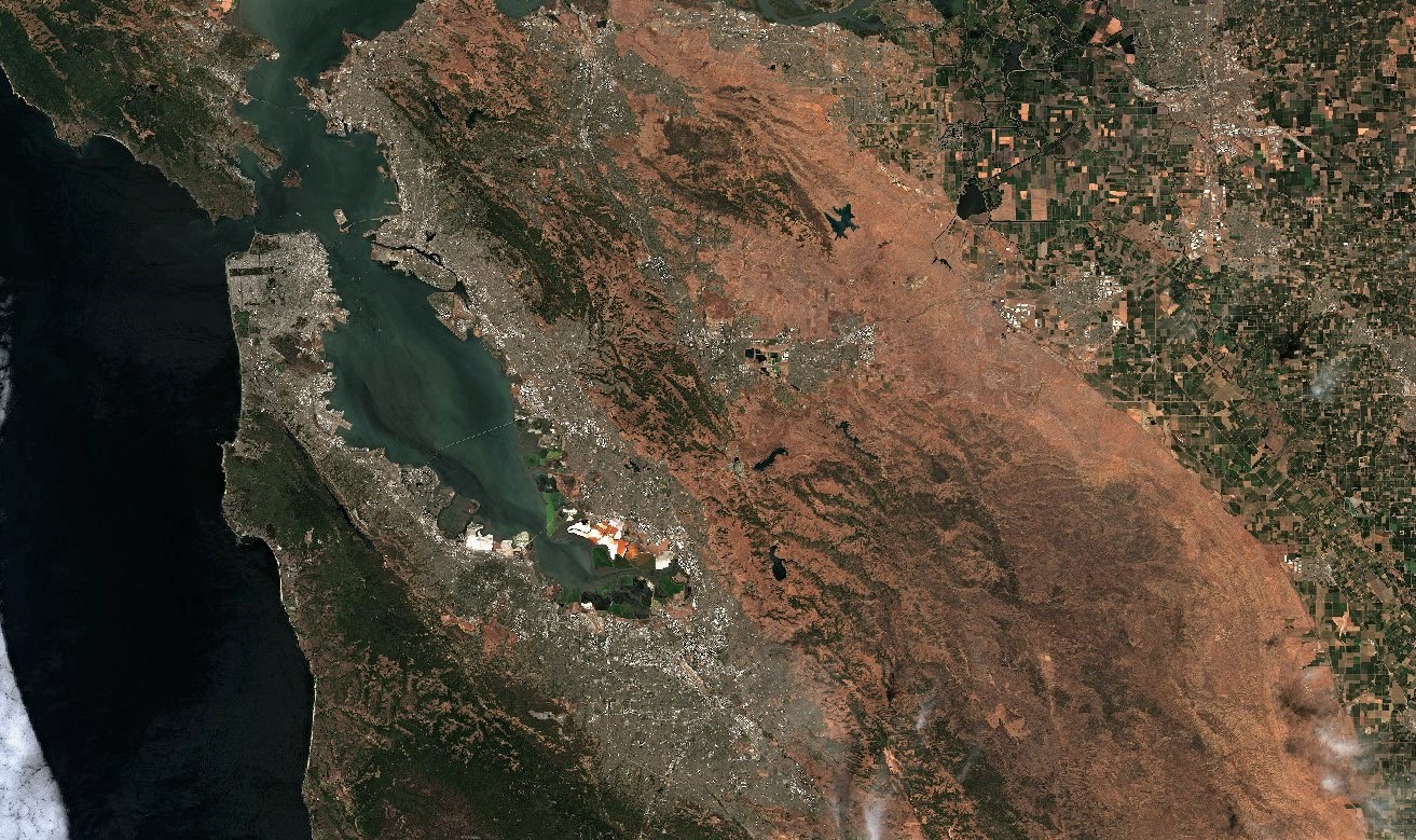
The observation of the world through satellite imagery has greatly improved in the last 20 years. Public domain imagery from organisations like NASA and ESA has become better, and the private sector is actively putting up satellites creating images which can be purchased and put into commercial applications. This is a global frontier of observation of the world, and it is particularly valuable in data-poor situations.
Working with satellite imagery requires a combination of high-performance computation and statistical thinking. The datasets are extremely large and require special effort in computer engineering and data science. In addition, traditional statistics knowledge needs to be adapted to fit this space.
In order to understand the possibilities of this world, and to get people going with hands-on capabilities in working with this data, Chennai Mathematical Institute and XKDR Forum will organise a two-day workshop. Kawa Space is the knowledge partner for this event, and Spacefed is the ecosystem partner.
| Time | Topic | Speakers | 9:30 - 10:30 | Satellite data in the emerging world of alternative data | Hemen Sampat, JP Morgan |
|---|---|---|
| 10:30 - 11:00 | Night lights as direct observation of economic activity | Susan Thomas, XKDR Forum |
| 11:00 - 11:15 | Coffee break | - |
| 11:15 - 11:45 | Geospatial variation in prosperity: some evidence from satellite images | Carlos Mendes, Nagoya University |
| 11:45 - 12:30 | Satellite imagery as an input to credit access for low income households in agriculture | Debabrata Ghorai, Dvara E-registry |
| 12:30 - 13:50 | Lunch | - |
| 13:50 - 14:30 | The Suomi NPP and Sentinel satellites | Ayush Patnaik, XKDR Forum |
| 14:30 - 15:15 | Machine learning and satellite imagery | Sudhir Silwal, Aquaconnect | 15:15 - 16:05 | Real time application of satellite data | Devleena Bhattacharjee, Numer8 |
| 16:05 - 17:00 | Summing up | Ajay Shah, XKDR Forum |
| Time | Topic |
|---|---|
| 9:30 - 10:30 | Introduction to Julia |
| 10:30 - 11:30 | Satellite image data |
| 11:30 - 12:00 | Coffee break |
| 11:30 - 12:30 | Coordinate reference systems |
| 11:30 - 1:00 | Problems with raw nighttime lights and data cleaning |
| 1:00 - 2:00 | Lunch |
| 2:00 - 4:00 | Zonal statistics |
| 4:00 - 5:30 | Q & A |


Send your details through the Google Form and our admins will contact you.